Since 2012, Brett Helling has built expertise in the rideshare and delivery sectors, working with major platforms like Uber, Lyft, and DoorDash.
He acquired Ridester.com in 2014, the first ridesharing marketplace, leveraging his direct experience to enhance the site. His insights at Ridester are recognized by Forbes, Vice, and CNBC.
Ridester articles are reviewed by gig economy experts before getting published to ensure accuracy, thoroughness, and quality. Learn about our editorial standards.
Hi there! My name is Sam Choi, and I am a rideshare driver for both Uber and Lyft.
Ever since I started ridesharing, I’ve taken thousands of trips, and have been able to master every aspect of the job. I’ve interviewed numerous drivers, taken courses, read everything I could find on the web, and aggressively analyzed every shift I drove. As a result, I am personally am in the top 1% in the nation when it comes to earnings.
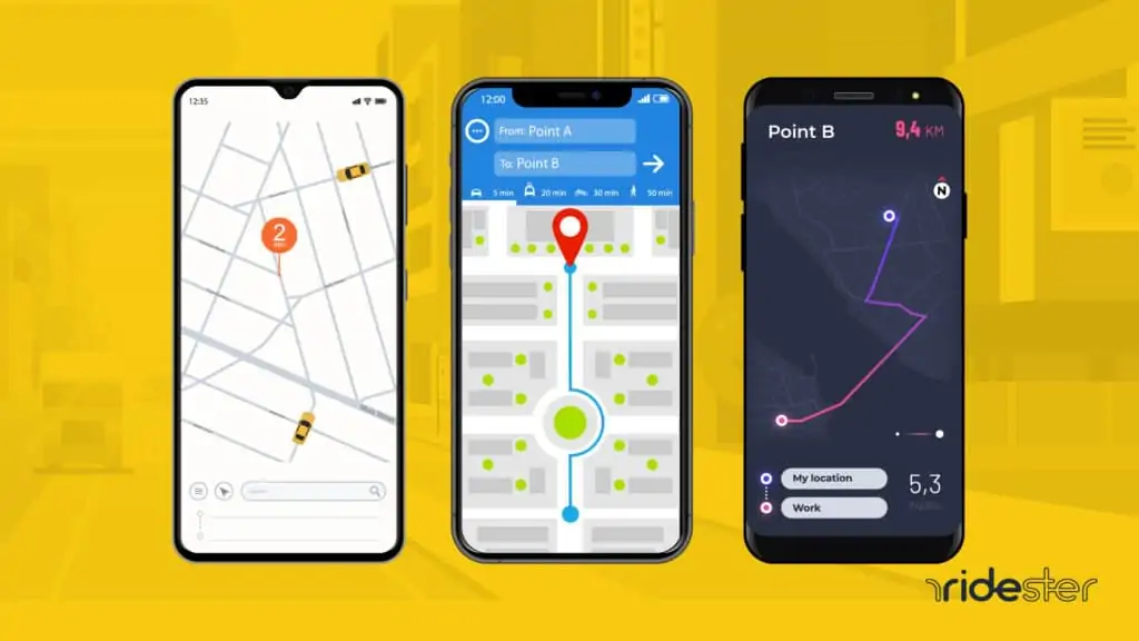
Uber Driver was Uber’s answer to all Uber drivers who would use external routing apps Google Maps, Waze and Apple Maps to figure out the best route to take the passengers from point A to point B without getting lost.
Unlike other navigation apps that’s made for general consumers, Uber Driver is specifically made for the drivers to do their job better and more efficiently.
This app is built into the Uber Driver App that you are already using.
Download Uber Driver
Compatible with: Any smartphone running Uber’s Partner/Driver App.
Many Uber drivers rely on the Uber Driver system while working.
This tool relies on data from several different mapping systems, including Google Maps, Bing Maps, deCarta, and TomTom in order to provide the most complete and accurate mapping system it can.
Also, since Uber drivers are already logged into the Uber Driver app, it offers the convenience of not needing to alternate between the Uber app and a third-party navigation app.
This app is especially enticing for drivers driving UberPool, because it involves many overlapping trips, pickups and drops offs.
This negates the need to toggle between external navigation apps to constantly update the next location.
With Uber Nav, you can string rides together, which means the app will automatically show you a preview of where to go next in advance after you drop off or pick up a passenger.
Like other apps, it does offer basic lane guidance, night mode, and real time traffic data.
Cons
Only drivers with Uber have access to this navigation system.
When this navigation system was first introduced, it was buggy, difficult to use, and often failed to provide the most efficient navigational routes.
Since then, however, Uber has worked hard to improve this system’s accuracy and performance, and today it is the top choice of many Uber drivers.
It is not as detailed or sophisticated as Waze or Google Maps.
So although not suited for a long distance road trip like USA to Mexico, with basic city driving, it will get the job done.
When it comes to free best navigation apps, Google is frequently referred to as the gold standard of navigating apps that many competing companies seek to beat.
This GPS navigation comes pre-loaded on many Android phones, and several iPhone owners have found it to be superior to the Apple Maps that is the default GPS system on their phones.
Download Google Maps
Compatible with: Android and Apple wireless phones
This is the established industry standard for free wireless GPS mapping systems.
It features one of the most sophisticated mapping tools available.
Some of its many benefits include a clean interface, turn by turn directions, indications when you are nearing your exit, the ability to reroute in the event of heavy traffic, voice guided navigation option, and the visual display of all lanes on the highway.
The lane assist feature is very important as it guides you to the proper lane before you miss your exit.
With lane guidance, you can clearly see which direction each lane will take you.
If you are driving in an area where there is no wifi, you can save your location from Google maps to your cell phone and access the route offline.
Also, Google acquired Waze in 2013.
While these two apps are still operating independently, this acquisition has enabled Google Maps to rely on great real-time traffic information as provided by Waze.
It allows you to see the distance and estimated arrival time, along with informing you of crashes or construction works that might delay the commute.
You can then use this traffic alerts to pick alternate routes seamlessly.
One other charms of this app is its simple design, which makes it the perfect choice for speedy location searches.
It also offers spelling correction and auto completion feature to make the process faster.
Google maps also has a night mode feature that automatically gets activated at night (not just dark).
This is very helpful to prevent your eyes from getting tired and strained from constant shifting between a bright screen and the dark road ahead.
Cons
Also, this app is not as compatible with wearable devices as the Apple Maps are.
But it is available on Apple watch.
It can be slow to load at times and uses a lot of system power to run, essentially causing the battery to drain quickly.
iPhone loyalists tend to prefer Apple offerings over other options.
But once upon a time, Apple maps was practically unusable!
It was so buggy and unreliable that Tim Cook had to publicly apologize for releasing a subpar product.
That’s not the case anymore.
Since, iOS 11 update, Apple’s native navigation app has vastly improved with the addition of so many impressive feature set to the point where you safely depend on it instead of Google maps to reliably take your passengers to their location.
This app is compatible with wearable devices such as the Apple watch.
Users wearing these devices can receive notification via a series of vibrations which will allow them to know that a turn is coming up, and which direction they will need to go.
It offers a lane guidance feature that aids driver to stay on the correct lane to make their turn or exits.
It also has a speed limit notification feature, and a do not disturb feature that prevents distractions by blocking your device from receiving most notifications while you are driving.
Additionally, it offers a light guidance feature.
If you would like to see the bigger picture of the navigation route you can easily switch to this view, and switch back to full guidance to get turn by turn directions.
To offer its users real time traffic data, Apple has partnered with Tom Tom, and acquired the mapping company Coherent Navigation.
Using these two sources, Apple derives intelligent traffic data that its user can use to then identify congested road that’s backed up with traffic.
The app suggests alternate routes options too.
Cons
When Apple Maps first launched, it was buggy, filled with user-interface problems, and often gave inaccurate directions.
Much has improved since then, but many users who switched to alternate GPS units are wary about coming back.
And while Apple has been working hard to improve this system, so too have its top competitors.
Although Google purchased Waze back in 2013 and integrated several of its features into Google Maps, Waze has continued to operate independent to Google as a good GPS navigation app of its own still loved by millions of users everywhere.
While Google map is a comprehensive navigation system that serves multitudes of modes of travel including walking, Waze is hyper focused on driving.
Many people love this app because it crowd sources real time data that helps users steer clear of heavy traffic situations and accidents.
Users can make active contribution regarding traffic status and other road conditions.
This keeps all the users within the network up to date on their commute, and gives everyone a chance to pick the best route to their destination.
The users also offer information pertaining to traffic backups, speed traps, and road other road hazards, and Waze uses this real-time information to offer alternate routes to those who are using the app for navigation.
This app even allows for map updates to improve accuracy, and lets users find community-recommended restaurants and close-by gas stations featuring the cheapest fuel prices.
The interface is very easy to learn.
It’s as simple as entering the address, and receiving the best route.
The app does recognize voice commands, so you don’t have to manually input an address to it while driving.
And, Waze offers Spotify integration that lets you access Spotify playlists from right within the Waze app.
Cons
Some people find the maps cluttered, particularly on the small screen of a smartphone.
Also, in less populated areas, the information offered may be less accurate or useful, though this is not typically a problem in locations where rideshare services are popular.
Waze does not offer lane guidance.
Also, this app also uses a lot of data resources, so unless you have it plugged into a car charger, it is likely to drain your battery very quickly—even when it is just running in the background.
This app features 3D maps, which many people find to be more intuitive when navigating unfamiliar roads.
Also, because it works using the infotainment system on your dashboard, your navigation view-screen is larger and easier to see than the smaller screen of a smartphone.
Other attractive features of this app includes speed limit tracker which shows your current speed, along with the speed limit of the road you are travelling on.
It provides drivers with real time traffic information based on your current location and road conditions, along with informing drivers of speed traps.
It offers automatic rerouting, sharp curve warnings, dynamic lane assistance, speed camera warnings, points of interest, and route planning.
Turn by turn voice guidance is available in over 50 languages.
It has a Head Up (HU) display feature that projects the navigation onto your windscreen in your line of sight.
That way you don’t have to shift your focus from road to the screen constantly.
This feature only works at night.
Another unique benefit of this app is that it can continue to run, even when you are offline.
Cons
As far as navigation apps go, this one is rather expensive.
However, the cost is a one-time fee and includes free-lifetime updates.
Also, if you keep your eye open for sales and promotions, you may be able to purchase this product for as much as 70% off the listed price.
Navmii is a free navigation app that along with other basic route information also provides users with offline maps in cases where data is connection isn’t available.
They sources their mapping data from OpenStreetMap.
Pricing
This app is, for all intents and purposes, free.
However, this app is ad supported, and these ads can be distracting and annoying and can slow your system down.
By purchasing the premium version for a mere $2, you can avoid this irritation; so many people opt to do that.
You can also purchase a number of different upgrades to customize this app to your specific wants and needs.
How it works
Navmii GPS World (also referred to as NavFree) is headquartered in London.
They are proud to have launched the first free navigation app on iPhone.
This app offers users a free navigational tool with the option to customize the user experience for small fees.
Download Navmii
Compatible with: Apple, Android, Blackberry and Windows Phone
Navmii features voice-guided navigation, which allows you to drive without taking your eyes off the road to glance at the map.
Because the maps are downloaded and stored by the app, you can use it offline which may be necessary in spots where you do not have a solid data connection, or if you are trying to conserve data usage.
Users can also purchase additional add-ons such as celebrity voice navigation (that includes Stephen Fry and Snoop Dogg) or live traffic updates.
Like Waze, it crowdsources real time traffic information from millions of other Navmii drivers, and the global SaaS company Inrix.
This data can be used to avoid congested paths, road closures, and speed traps.
It offers turn by turn voice guidance and presents users with alternate routes in case of road hazards.
When offline though, these real time traffic updates feature will not work.
You can upgrade and get add on features that gives you information on speed limit and red light camera at traffic light.
Cons
Some users find the quality of navigational images to be somewhat lacking in quality.
Also, because individual maps must be downloaded, you may use up data if you do that without a Wi-Fi connection.
This app was created by a development team in Germany and was originally designed for navigation throughout Europe.
Since then, they have opened their system to North America, Australia and New Zealand.
Its navigation feature is designed to provide the fastest route to your destination.
Pricing
Free 7-day trial period
$4.99 per month
$29.99 per year
$59.99 for lifetime service
How it works
The Navigon navigation app focuses on getting you to your destination in the quickest time possible.
Just like Sygic, this app caters to offline navigational guidance, and like Navmii, it offers different options based on your region.
Download Navigon
Compatible with: Apple, Android and Window phones
Get this app: Google Play / App Store
Pros
This app can work online as well in areas where there is no internet connection.
This lets you continue to navigate even when driving through remote backroads with no network.
It also enables users to find the lowest-priced fuel in the area as well as free-parking close to their destinations.
It is exceptionally good at finding points of interest and specific locations.
You can get 3D displays of the routes, live traffic updates but for an additional price.
It has a voice navigation feature that is very helpful, and with just a tap on the screen you can get the app to repeat the next turn.
The app also mentions the street names, and it presents the driver with several route options and reroutes pretty quick during a detour.
Cons
For its price, the app should work better than it does.
Some users complain about navigation directions that are impossible or downright dangerous.
Additionally, this app is rather expensive; and many of its features, such as traffic updates and transit directions, must be purchased at an additional fee.
Most people seem to find the free Google Maps app comparable or even better in many regards.
Why Is Navigation Important for Uber Drivers?
Effective navigation is crucial for Uber drivers to optimize their time, increase earnings, and maintain a high Uber rating.
Knowing the city well is one thing, but unfamiliar neighborhoods and tricky street layouts necessitate a reliable navigation system.
This system aids in efficiently reaching the pickup location, which can be challenging if the Uber app inaccurately marks a rider’s location. Missteps here can lead to delays, cancellations, and wasted time.
Successfully navigating to the destination promptly is equally important. Wrong turns not only extend the ride time but may also lead to higher charges for the customer due to a longer route, affecting the driver’s rating negatively.
A driver’s ability to swiftly pick up and drop off customers, avoid traffic, and choose the shortest routes directly influences their ratings and reviews.
Positive feedback and high ratings are vital, as even a few low scores can significantly impact a driver’s overall rating.
Uber sets a high standard, with the possibility of deactivating accounts with ratings below 4.6 stars, underscoring the importance of navigation skills in ensuring a driver’s success and continuity on the platform.
What to Look for in Navigation Apps for Rideshare Drivers?
Now that you understand the importance of getting the best street-level navigation, which mobile app is best?
Is there a particular Android or iOS app in the app store you should choose, or is there a particular feature to look for?
1. Accuracy & Reliability
When picking a GPS app as an Uber driver, accuracy and reliability are the most important features to look for. Remember, all it takes is for the app to mess up once, causing you to receive a bad rating from a passenger.
It’s not just the navigational capabilities of the app that you need to care about. If the app lags or freezes, or simply takes too long to show you where to go, you may end up taking a wrong turn.
2. Does the App Reroute You?
This feature is essential. Even the best Uber drivers can take a wrong turn once in a while.
It happens – you’re approaching a complicated junction or roundabout, and you take the wrong turn or exit. The critical thing is whether the app can quickly recalculate and reroute you, using the shortest route possible.
3. Does the App Work in Your Locale?
Some apps work better in some areas than others. Even Google Maps or Apple Maps may not be equally effective in different cities and towns.
Generally, the more rural you get, the less accurate navigation apps tend to become. Before settling on an app, make sure it works well in your area.
4. Do You Get an Estimated Time of Arrival (E.T.A)?
The app should also give you an estimated time of arrival. That way, you can keep your passenger updated on when they can expect to arrive.
Of course, the ETA can always fluctuate based on traffic conditions, but getting an estimate is helpful. It will also help you decide on how to manage your schedule for the rest of the day, in case you need to be somewhere later.
5. Does the App Offer You Alternate Routes and Options?
A good navigation app will offer you more than one route. For example, Google Maps offers you several routes at once.
While it will select the shortest route by default, it will also show you alternative routes and how long they will take.
As an experienced driver in your city, you may know that some main roads are more prone to congestion than others and decide not to use them, even if it is the default option on the app.
Similarly, Waze gives you several routes. If an app only gives you one route, you may end up wasting time in traffic.
Final Thoughts
Now it’s your turn. As you experiment with different GPS navigation apps, you will likely find that one stands out as your personal favorite.
What you find to be the right choice for you may differ from your Uber-driving friend in another city.
That’s okay. Just as rideshare services offer people choices in how they get around, GPS apps offer drivers choices in the product that will best get them there.
We would be interested in hearing about your experiences with various apps. Is there one that you can’t live without? Did you come across one that you regretted using? Let us know in the comments.
1 thought on “The Best Navigation Apps For Uber [& Why We Picked Them]”
Thanks Brett! I just finished reading your book “Gigworker”. I’m a 20 year retired engineer who’s been driving for UBER for the last 3 years, just to bring in a little more $$ in retirement and to get out of the house. I really enjoy driving for UBER, so I just went on to the “Ridester” site. I’ve already picked up some info that will help me be more efficient. Thanks for the insightful suggestions.
Do you know of any other app gigwork other than the few you have listed on the site. I don’t want to deliver meals. I’ll look for your response on my email account.